Precision in Every Measurement
- Phone: 086 172 8780 / 046 9043001
- Mon–Fri: 8:00 AM – 5:00 PM
Our Legal Mapping & Boundary Dispute services provide precise survey data to resolve boundary questions, support legal documentation, and ensure compliance with property regulations.
Resolving boundary disputes and producing legally defensible maps requires accuracy, clarity, and reliability. Our services provide trusted survey data that supports planning, development, and dispute resolution.
We assess the property, review relevant documentation, and determine the survey methodology needed to establish accurate boundaries.
Our surveyors collect measurements using GPS, total stations, and laser scanning to map property lines, features, and legal boundaries accurately.
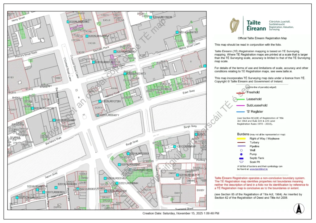
Survey data is processed into clear maps, plans, and documentation suitable for legal submission, planning, or property management.
Survey results are delivered in required formats, with guidance for legal, planning, or development purposes.
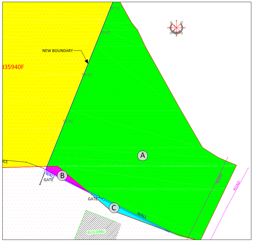
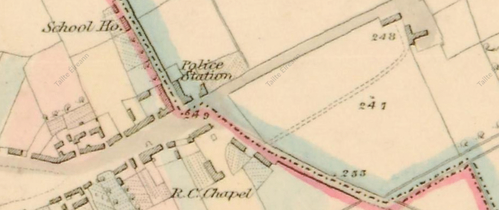
Our Legal Mapping and Boundary Dispute services assist clients in clearly defining property extents, resolving boundary disagreements, and providing robust, defensible evidence for planning applications or legal proceedings. By conducting highly accurate and thorough surveys, we ensure that all decisions are based on precise, reliable information, minimizing the risk of disputes or complications. Whether for private property matters, commercial developments, or public infrastructure projects, our services give clients the confidence that their boundaries are correctly identified, documented, and legally sound, supporting smooth project execution and long-term property security.

Precision. Accuracy. Professionalism.
Providing land, engineering, and measured building surveys across Ireland.
Unit 10, Roche House Mall, Longwood, Co. Meath, Ireland.
See on Google Maps
086 172 8780 / 046 9043001
info@jweirlandsurveying.com