Precision in Every Measurement
- Phone: 086 172 8780 / 046 9043001
- Mon–Fri: 8:00 AM – 5:00 PM
Home / FAQ
We offer surveying services across all of Ireland. Projects can be scheduled nationwide depending on scope and requirements.
Yes, we deliver high-quality digital outputs, including CAD drawings, 3D models, and other formats as required by clients for design, planning, and construction purposes.
Absolutely. Our Legal Mapping and Boundary services provide precise, defensible surveys to help resolve disputes and support legal or planning processes.
We typically require project plans, site access details, and any previous survey or design data to ensure accurate and efficient survey execution.
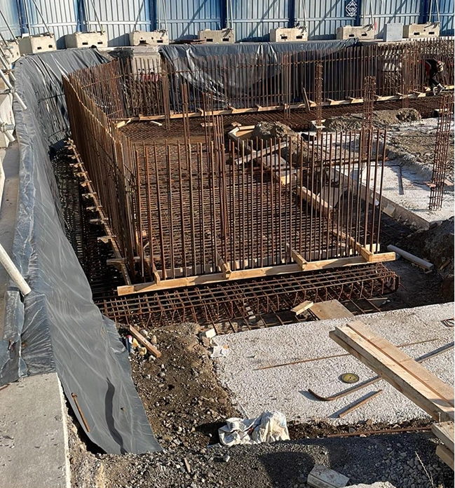
We provide a wide range of services, including land surveying, building surveys, laser scanning, earthworks & volumetric reporting, site control networks, digital ground modelling, and legal mapping.
Our surveys use the latest technology and industry best practices to ensure highly precise measurements, reliable data, and minimal margin of error.
Yes, we offer comprehensive project management services to oversee all survey operations, ensuring timelines, budgets, and quality standards are maintained.
Definitely. We have experience supporting projects ranging from residential developments to major infrastructure and civil engineering works.
All client data and survey results are treated with strict confidentiality and stored securely. Access is only granted to authorised personnel.
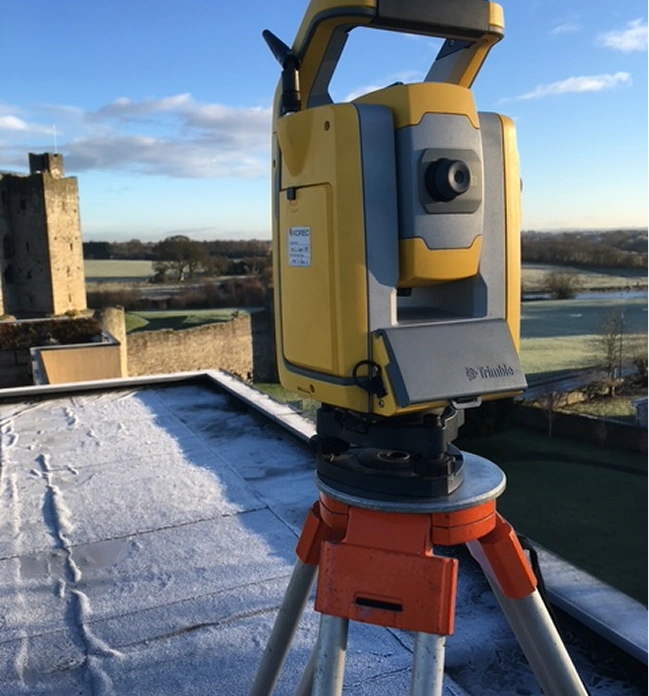
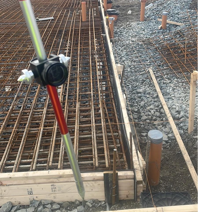
We use advanced surveying equipment, including total stations, GPS/GNSS receivers, 3D laser scanners, drones, and high-precision software for data processing and modelling.
Yes, we can schedule regular updates and progress reports to keep clients informed throughout the project lifecycle.
Our digital ground models provide accurate 3D representations of the terrain, helping clients assess slopes, drainage, and earthwork volumes for better decision-making and risk management.
We provide guidance and support to help clients interpret survey data, including CAD files, 3D models, and volumetric reports.
Our survey teams coordinate closely with site managers to plan surveys efficiently, using techniques that reduce interference with ongoing construction or operational activities.
Speak with our team about your upcoming project requirements. We’ll provide guidance, timelines, and a tailored survey plan to ensure you have the information you need to proceed with confidence.

Precision. Accuracy. Professionalism.
Providing land, engineering, and measured building surveys across Ireland.
Unit 10, Roche House Mall, Longwood, Co. Meath, Ireland.
See on Google Maps
086 172 8780 / 046 9043001
info@jweirlandsurveying.com