Precision in Every Measurement
- Phone: 086 172 8780 / 046 9043001
- Mon–Fri: 8:00 AM – 5:00 PM
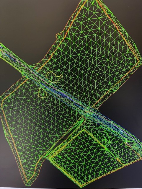
Our Digital Ground Modelling services produce accurate three-dimensional representations of terrain and site topography, providing essential data for planning, design, and construction projects.
Digital ground models allow clients to visualise and analyse terrain and site conditions in detail. Our approach delivers high-resolution, actionable terrain data that supports informed decisions and efficient project delivery.
We review project requirements and determine the optimal survey methodology, resolution, and modelling approach.
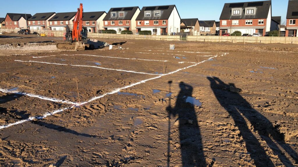
Our team collects topographic and structural site data using GPS, total stations, and laser scanning.
The collected data is processed into detailed digital ground models, 3D surfaces, and CAD-ready outputs suitable for design, earthworks, and planning.
We supply digital models and data in the required formats, with guidance for design, planning, and construction applications.
Our Digital Ground Modelling services play a crucial role in infrastructure design, civil engineering, and construction projects of all scales. By creating precise 3D representations of the terrain, we enable clients to thoroughly assess site conditions, including gradients, drainage patterns, and earthwork volumes. This level of detail helps identify potential challenges early, reduces project risks, and supports smarter, data-driven decision-making throughout the design and construction phases. With our accurate terrain models, planners and engineers can optimise resources, streamline project workflows, and ensure that every development proceeds with confidence and precision.

Precision. Accuracy. Professionalism.
Providing land, engineering, and measured building surveys across Ireland.
Unit 10, Roche House Mall, Longwood, Co. Meath, Ireland.
See on Google Maps
086 172 8780 / 046 9043001
info@jweirlandsurveying.com